Exploring the Future of Airborne Remote Sensing
Could drones be part of the National Ecological Observatory Network (NEON) project's arsenal of data collection platforms one day?
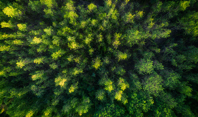
Drones are gaining popularity in environmental and agricultural applications. Farmers use drones to monitor crop growth and plant health. In the ecological community, drones have been used to gather remote sensing data after floods or forest fires, track wildlife, conduct geospatial mapping and monitor ecosystem change. Compared to traditional light aircraft missions, drones provide a cost-effective and easy alternative for gathering a variety of airborne data products.
Their low cost and versatility could help the NEON project expand its airborne remote sensing capacities. Before integrating them into NEON's operations, however, more work has to be done to see how they compare to our existing airborne platforms and to develop workflows and data delivery mechanisms. A recent Battelle study took the first step towards evaluating their use for remote sensing for NEON.
Expanding Airborne Remote Sensing Capacity for the NEON Project
The NEON project already has remote sensing capabilities in the form of Airborne Observation Platforms (AOPs). The AOPs are light aircraft equipped with a payload of sophisticated sensors, including a hyperspectral imaging spectrometer, a high-resolution camera and a full waveform and discrete return LIDAR system. These sensors make the AOP a powerful remote sensing platform. The AOPs offer a full spectrum of high-resolution remote sensing data. These data—which are used to produce a range of data products such as Leaf Area Index, total biomass and other vegetation indices along with topographical data—are part of the NEON remote sensing data product suite available through the NEON Data Portal.
While drones currently lack the payload capacity for sophisticated sensors required to wholly replace the AOP, there is tremendous potential for drones to expand the temporal coverage of remotely sensed data products at greatly reduced costs. Adding drones to the NEON toolbox would allow researchers to collect data outside the regularly scheduled AOPs flights and respond more nimbly to extreme events and other time-sensitive research opportunities.
As an initial step toward incorporating drones into the NEON project, Battelle scientists are working to assess the correlations between drone-collected and AOP data. To date they've tested three platforms: the DJI Phantom 4 Quadcopter (popular with serious hobbyists), the DJI Matrice 210 and the DJI Matrice 600. Experimental flights were conducted in concert with AOP calibration flights to collect initial data under the same atmospheric and light conditions. These flights also served to develop data processing workflows, storage methods and delivery mechanisms. Most importantly, these initial data, and data from flights planned later in the summer, will be the foundation for correlating drone and AOP data products.
The sensors currently being tested provide a limited, but valuable, set of vegetation indices, such as the Normalized Difference Vegetative Index (NDVI). This provides an important indicator of vegetation health. The drones could one day be outfitted with a variety of different sensors that could be swapped out depending on the needs of the project. These could include a full hyperspectral imaging spectrometer, high-resolution cameras and LIDAR. Someday, drones could even be equipped with sampling equipment—for example, to collect water from the middle of lakes or acid mine drainage sites.
The Future of Drones at the NEON Project
As drones continue to get more powerful and less expensive, their potential for environmental data collection will only continue to grow. This study puts the NEON project one step closer to integrating the use of drones with our other data collection efforts.
The incorporation of drone technology into the NEON network also furthers our capacity to serve as a collaborative partner in modern ecological research. Already, additional partnerships are being investigated, including a joint project between NEON, the University of Colorado–Boulder and The High-Latitude Drone Ecology Network at the NIWOT LTER/NEON site. This collaboration will facilitate interoperable remote-sensing data products between the various networks. It serves as a test case to collect project logistics information that will guide the development of drone-based remote-sensing services.
Eventually, drones could be flying regularly over NEON field sites and be available for outside researchers as part of the NEON Assignable Assets program. Ultimately, they will help the National Science Foundation’s goal with NEON, a user facility that provides a diverse suite of comparable and consistent ecological data at multiple spatial and temporal scales. The data collected through these studies are an important step forward towards expanded remote sensing capabilities.
Related Blogs

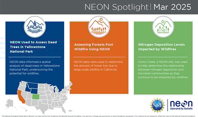
NEON’s Impact on Wildfire Research: Assessing Dead Trees in Yellowstone National Park, Forest Loss in California and Nitrogen Deposition Levels in Colorado
Read More
BATTELLE UPDATES
Receive updates from Battelle for an all-access pass to the incredible work of Battelle researchers.